We clear the treeline and have no words. The valley looks as if God's boat had sailed through, the keel carving the rock and leaving fecundity in its wake. Below are the trees we spent an hour hiking through, above are green grasses dotted with purple and yellow flowers, their petals high enough to brush my biceps. This mountainside meadow spreads up until it merges with the grey rock and white snow that mark the peaks of the Tatras mountains.
Up there, facing each other across a saddle are the highest points in Slovakia and Poland, for this range marks the border between the two countries. The Slovakian peak, barely 150 feet higher than its Polish partner, is inaccesible without a guide. But Rysy, the Polish peak, has a trail right to the top and is frequently climbed from both sides of the border. At 8,199 feet, this should be a cakewalk.
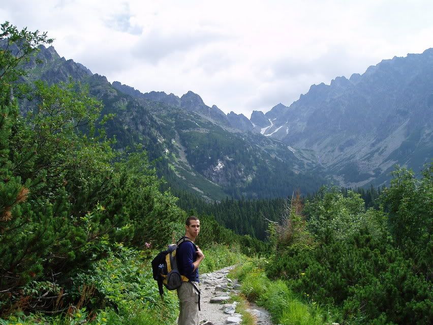
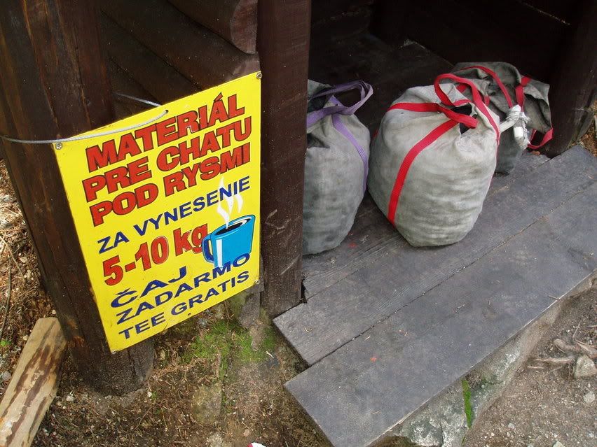
Carrie and I are hiking extremely light on this trip: tennis shoes and day packs. We're walking past those who took this trail a little more seriously, who are heavy with their hiking boots and refrigerator backpacks. I suppose we could have weighed ourselves down more: at the bottom of the trail were bags of coal and a sign that promised a free drink at a hut on top of the mountain if you brought one up. Beside the coal were two wooden frames with shoulder straps, each ladden with 70 pounds of firewood. For shlepping that to the top, you would get a free night's stay. Someone had taken that offer, and as we were climbing down, we saw someone, bent nearly double with the wood frame on their back, their own backpack strapped to the frame. When we got closer, we saw that it was a woman.
The way up was beautiful, walking through those angled mountain meadows fed by cold mountain streams that we crossed via woode bridges. These gave way to glacial lakes as the weather briefly broke. As it lightly rained we walked past a stream running over and waterfalling down the mountain side.
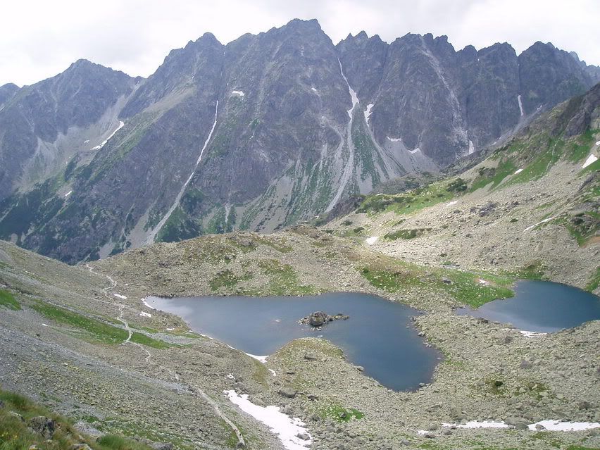
Glacial lakes
The terrain seemed to change every 20 minutes: after the rain stopped, we had to use ropes and chains to get up the slick, steep rock, and then we hit the snowpack. I slipped and fell a couple times, my cheap, Ukrainian sneakers finding no purchase on the icy snow.
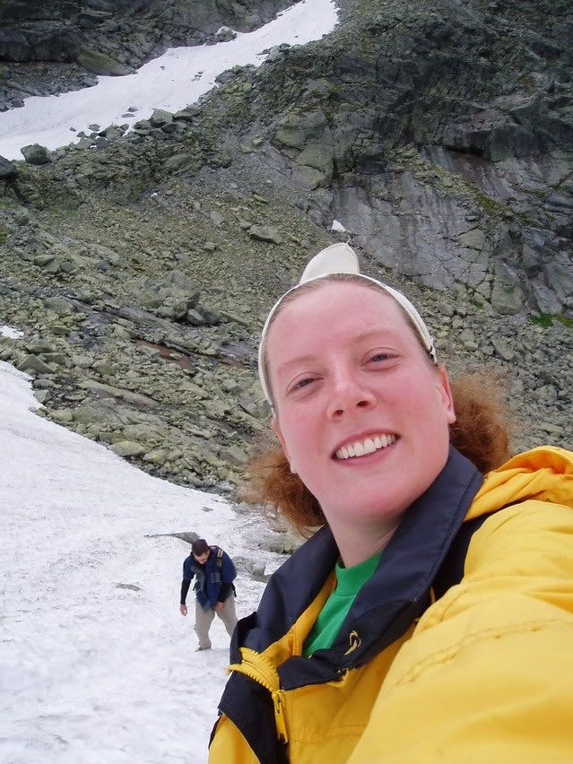
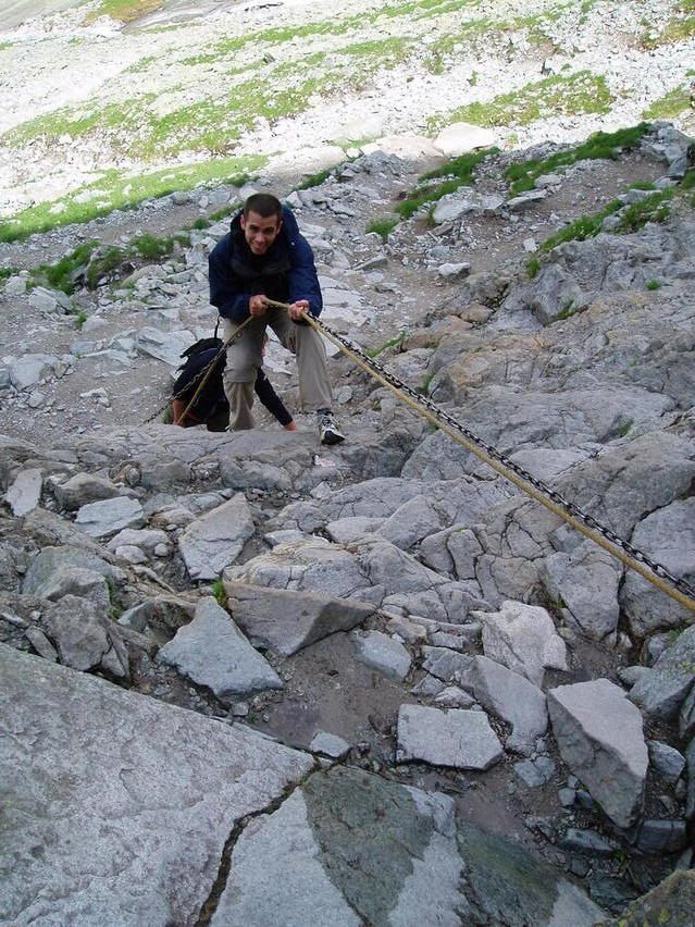
Using the ropes and chains to climb up. Carrie on the snowpack, me slipping below her.
We passed the mountain hut and kept going, trudging up the snow until it gave way once again to rock and the saddle between the peaks. We were nearly blown off our feet by the gusts of wind that hit as as soon as we cleared the valley walls.
The red and white blazes marking the trail disappeared and we followed two people ahead of us. We found ourselves climbing, using hands and feet as the trail completely dissapeared. Looking up, my hood acting as a sail in the wind and tugging at me, I saw the top of the mountain. Rather than a peak, it ended in a straight, thin line, one you would have to straddle just to say you were on top, because there was no room to stand. With the gusting wind, I was genuinely worried that we would get blown off the top.
Then we looked back and saw other hikers, saw the path leading up the other peak. We were on the wrong mountain and were twenty minutes from scaling the highest peak in Slovakia, even though we weren't legally allowed to do so.
Despite my fear, I entertained the notion of finishing it, but Carrie firmly refused. We climbed back down and followed the path up to the other peak. The two people that had been ahead of us kept going, still climbing. Whether they were mistaken, one was a guide, or they were just doing it, we never found out.
The other peak was much easier to summit, requiring only a bit of scrambling at the end before we passed a sign saying we were now on Polish territory, and then we were at the flattened top of the point. The views were amazing, and we stopped to eat lunch there, chatting with an Australian who had come up from the Polish side, a Swiss would had come up from the Slovakian.
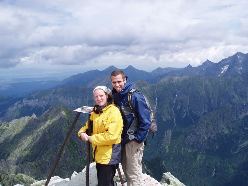
At the top!
Carrie and I had made it up in 3.5 hours. It was supposed to take us 6. Our lunch finished, we blew back down the mountain, passing the laden people who we had passed on the way up. When we hit the snow pack, we both simply sat down and slid, an exciting, slighlty out of control plummit down towards the rock. An elderly couple who were hiking came up in front of us. Carrie stopped short, and I ran into her. Rather than stopping, I sort of bounced around her, angling past the couple before the snow leveled out and I was able to stand up. A Slovakian family, who was just beginning to go up the snow pack and had watched me come down, congratulated me.
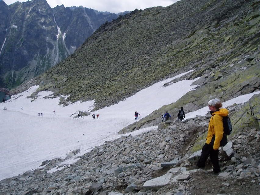
The snowpack we slid down.
In any case we made it to the bottom, and for less than four dollars, I celebrated our topographical victory with a fantastic steak dinner with a cold Pepsi.
Life was sweet.
No comments:
Post a Comment